So far I have looked at how Nottingham has been affected by too much water, not enough water, weather that was too cold and weather that was too hot. There have never been any earthquakes or tsunamis here, thank goodness. That is not to say, though, that Nottingham has never been troubled by high winds. All right, it cannot rival Texas or Oklahoma. Neither Dorothy nor Toto ever lived here, and we just cannot compete with things like this:
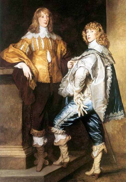
But we do try our hardest. We do our bit. Or at least we did do, way back in the sixteenth century. Just to continue with our policy of showing you the clothes and the costumes, so that you can work out what time period we are talking about, here are some of my favourite people from the era in question, having a game of bowls while they wait for a decision about the Armada from the European Court of Justice:
Back to the story….
On Monday, July 7th 1558, Nottingham was struck by a tornado. All of the ordinary houses within a mile of the city were destroyed. Sir Richard Baker reported in his now forgotten but once extremely popular “Chronicle of the Kings of England from the Time of the Romans’ Government unto the Death of King James”:
“On the 7th of July, this year, within a mile of Nottingham was a grievous tempest with thunder, which, as it came through beat down all the houses and churches, cast the bells to the outside of the church-yards, and twisted the sheets of lead like a pair of leather gloves and threw them four hundred foot into the field. The River Trent, running between the two towns, the water, with the mud in the bottom, was carried a quarter of a mile, and thrown against trees, with the violence whereof the trees were torn up by the roots, and cast twelve score yards off:
A child was taken out of a woman’s arms, and carried up into the air then let fall, had its arm broke and died. Also, a child was taken forth of a man’s hand and carried two spear’s length high, and then let fall two hundred feet off, of which fall it died.Five or six men thereabouts were killed yet had neither flesh nor skin hurt. They were slain by the storm, during which, hailstones fell measuring fifteen inches in circumference.”
The “two towns” are thought to have been the villages of Wilford and Lenton which at the time were rural, agricultural villages of roughly similarly size, separated from the main town of Nottingham.
Elsewhere in the East Midlands, on an unknown date in July 1558, in Northamptonshire, there was a storm with immense hailstones some fifteen inches around:

I do not know if these two events were connected or not. Overall in England, it was a very hot summer in 1558 with long periods of drought throughout the whole year. In March of 1558 the country had already seen the “most destructive hurricane in England”, although I have been unable to locate the precise whereabouts of this occurrence, and Nottingham seems to have been unaffected.
Eighty or so years later, on Wednesday, October 13th 1666, there was a similarly violent storm just a little further north. Called a whirlwind at the time, it actually seems to have done enough damage to warrant being called a tornado. How fashion tastes change in only a hundred years:
This account comes from “A General Chronological History of Air, Weather, Seasons, Meteors in Sultry Places and Different Times”, which was written by Thomas Short, and published in London in 1749:
“In Lincolnshire, there was a dreadful storm of thunder, accompanied with hail, the stones as large as pigeon or even pullet eggs, followed by a storm or tempest, attended with a strange noise. It came with such violence and force, that at Welbourn, it levelled most of the houses to the ground. It broke down some trees and tore up other trees by the roots. It scattered abroad much corn and hay. One boy only was killed. It went on to Willingmore (Wellingore?) , where it overthrew some houses and killed two children in them. Thence it passed on and touched the skirts of Nanby (Navenby?) and ruined a few houses. Keeping its course to the next town, where it dashed the church steeple in pieces, furiously damaging the church itself, both stone and timber work. It left little of either standing, only the body of the steeple. It threw down many trees and houses. It moved in a channel, not a great breadth. Otherwise it would have ruined a great part of the country. It moved in a circle and looked like fire. It went through Nottinghamshire, where the hailstones were nine inches about. The whirlwind was about 60 yards broad. On Nottingham Forest, it broke down and tore up at least 1,000 trees, overthrew many windmills, overturned boats on the River Trent. In a village of fifty houses, it left only seven standing.”
The original place names are given as Welbourn, Willingmore and Nanby. I have taken a quick look at the map and I think that Thomas was writing down the names of the places from a person who was talking to him. I can just imagine a local peasant of the time calling Wellingore, Willingmore and another slack jawed local pronouncing Navenby as Na’nby. As always, look for the orange arrow:
Here is St Chad’s Church in Welbourn, which survived the tornado more or less intact:
Here is the road near Welbourn:
That road takes you to Willingmore AKA Wellingore. Here is All Saints Church on a nice day and then on a Meteorological Office Severe Weather Tornado Risk Warning Day:
If Na’nby was Navenby, then this is St Peter’s church:
The “next town”, and I am merely guessing here, may have been Boothby Graffoe, which has its own ruined castle:
….and a church which over the course of the last 350 years seems to have recovered from what must have been, judging by Thomas’ account, a very bad hair day:
Here is a slightly better overview of the area to refresh your memory. All of my three best guess place names of Welbourn, Willingmore, and Navenby are in a nice, more or less straight line, as the tornado flies. It would be possible to argue that, if the fourth location is a genuine town sized town, then it might be Waddington, or even (less likely perhaps), the county capital of Lincoln. Boothby Graffoe, though, is a lovely village name. Perhaps not as striking as Norton Disney, but cute nevertheless.
Just take a look at this second map, showing clearly the path of the tornado through the three villages. I rest my case, as they say:
From my point of view, of course, the most interesting detail is the fact that:
“On Nottingham Forest, it broke down and tore up at least 1,000 trees.”
I have already written about the Forest Recreation Ground in Nottingham in a blogpost about a highwayman being executed on the gallows near St Andrew’s Church. Here is a map:
How do I know that this is the same place as Nottingham Forest? I know because of what used to be situated on Forest Road East, to the south of the green area marked “Forest Recreation Ground”. Here is an old, and no doubt, valuable oil painting of them. These are clearly what Richard was talking about when he mentioned that the whirlwind “overthrew many windmills”:
Enormous damage was occasioned in Nottingham:
“On Nottingham Forest, it broke down and tore up at least 1,000 trees, overthrew many windmills, overturned boats on the River Trent. In a village of fifty houses, it left only seven standing.”
In my opinion, this was because the tornado came from the south west, travelled, broadly speaking, to the north east, and was therefore much stronger in Nottingham than it was in Lincolnshire. This weather event may even be the reason that the Forest Recreation Ground was initially created. Having so many trees cut down together in what was then a heavily wooded part of Sherwood Forest itself, may have been the first step towards the vast open space that we all enjoy today. This map shows the general north easterly path of the tornado. The orange arrow points towards the Lincolnshire Three:
It is always difficult to prove a negative, but this map shows why mention of the tornado came only from Nottingham and the three small villages in Lincolnshire. Even now, 350 years later, there are comparatively few people living between the two localities to tell the story. And equally, there would have been, centuries ago, virtually nobody to tell it to.
Could somebody in England have recognised a tornado in 1666? Well, yes, he could, if he described the storm he saw as “attended with a strange noise”, as well as being “in a channel, not a great breadth”, “about 60 yards broad” and, most convincing of all, “It moved in a circle and looked like fire.” And don’t forget, it is always very difficult for a human being to describe something which is not within his terms of reference or his own personal experience.
Just compare those three hundred and fifty year old descriptions with this:
And watch out for Dorothy and Toto:


