I have always been fascinated by extreme weather, as many of you will have noticed. I recently came across an account of the Great Flood of Nottingham in 1875. It was in “The Date Book of Remarkable Memorable Events Connected With Nottingham and Its Neighbourhood” started by Mr John Frost Sutton and then continued by Henry Field.
The detailed account of the flood is particularly fascinating because it involves many streets which no longer exist. I was able to trace all of them on my Old Ordnance Survey Map for Nottingham (South) 1880. You can buy these on ebay or from a company run by Alan Godfrey .
The account begins with:
“October 22nd 1875
The greatest flood that has occurred in this century at Nottingham reached its height shortly before midnight, and, as viewed from the terrace of the Castle, was a scene never to be forgotten. Turn which way you would, the south side of town resembled a great sea, with here and there trees, factories, or blocks of houses standing out. The left portion had quite a Venetian aspect: people were moving to and fro, some on planks, some on hastily constructed rafts, fetching out their goods or those of some unfortunate neighbour, and floating them to higher parts.”
The castle has a tremendous view from the top of the cliff on which it stands:
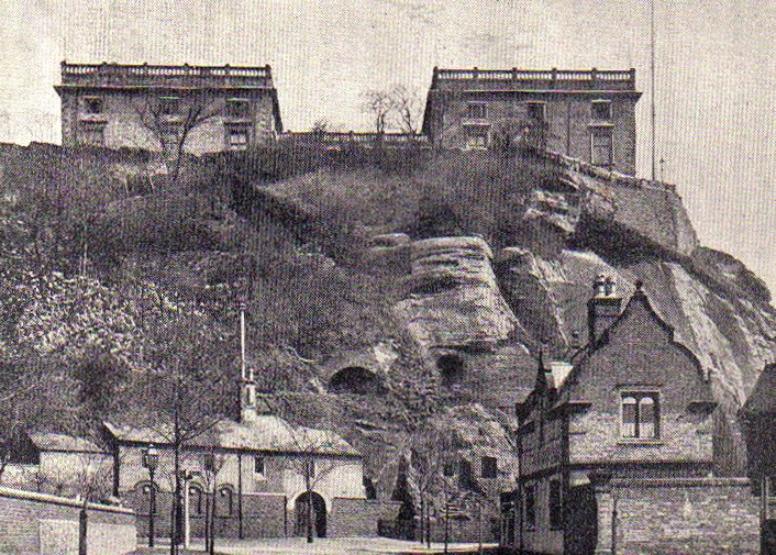
Here’s the terrace and a very poor view of the view:

The description continues with particular reference to individual streets, using the peculiar way of writing them as “Downing-street” for example. Many of them are no longer there in their ancient form, such as Arkwright-street and Kirke White-street. We only have the fossilised fragments of what they once were: `
“The Queen’s-walk was rendered impassable, and many of the houses on the sides had at least six feet of water in them. In parts of Queen’s-road, Arkwright-street, and Kirke White-street people were conveyed to and fro in carts. The water stood in the cellars of many of the houses in Leen-side, Carrington-street, Greyfriars-gate, and several other streets.”
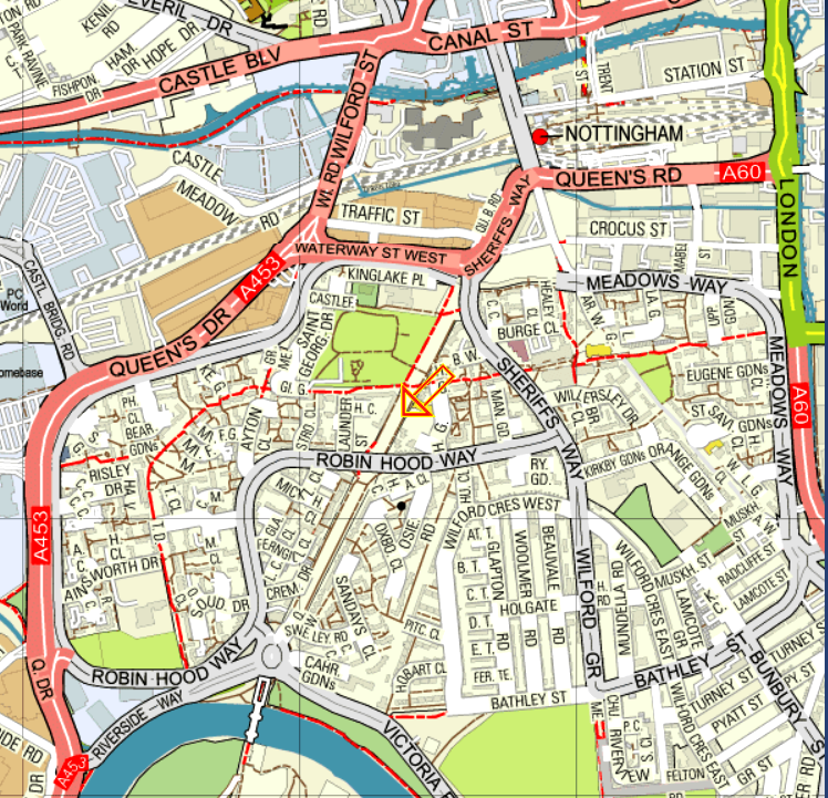
Let’s take a look at these more obscure Nottingham streets, because if a magic wand could be waved and they were reinstated, quite a few of Nottingham’s current traffic problems might be solved.
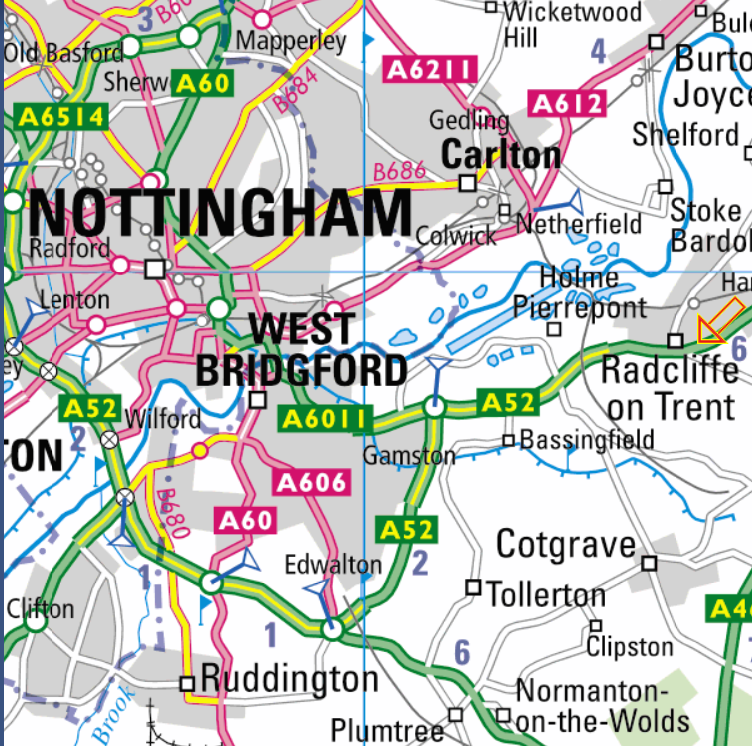
On the map below the orange arrow points to Queen’s Walk which I think is where the Manchester United footballer Andrew Cole originally came from. Queen’s Road, mentioned in the account of the flooding, is north east of the orange arrow and runs down the side of the station. Looking at the map, Queen’s Walk, still in white right next to the orange arrow, used to be a splendidly direct route out of the city to the south. Alas, it is now pedestrianized:
In the map below, Arkwright-street used to be a very big and important thoroughfare. It ran south of the station and curved gently but directly to Trent Bridge. It is there nowadays in a similar fossilised form. Find the red dot that marks the station at the top of the map below and follow it south eastwards towards the river in a long, long curve past the orange arrow and across to Trent Bridge, with the road number A60 on it. Nowadays, alas, this is not a continuous route for cars:

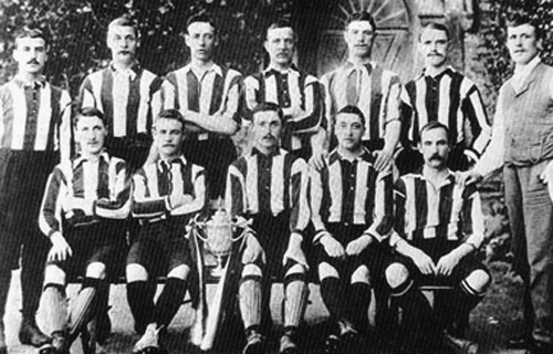
Kirke White-street was equally important. It ran from the canal on London Road straight as an (orange) arrow until it reached Wilford Road in the west. Kirke White-street crossed right through The Meadows, which were some of the most impressive slums in the whole British Empire. Even in 1970, children could be seen barefoot here, In the 19th century, its inhabitants provided the huge crowds that kept Notts County in the First Division and helped them to win the FA Cup:
After World War Two the inhabitants of the Meadows were moved en masse to Clifton Estate, some three or four miles outside the City.
Kirke White-street was a much used east to west route across the city and then out via Wilford Street and Wilford Road to Birmingham and the south west. On the map below, the long lost fossilised path of Kirke White-street is very roughly the red dotted line going east to west. Wilford Street and then Wilford Road is in the top left corner. It very quickly changes into the A453 which was the old main road to Birmingham:

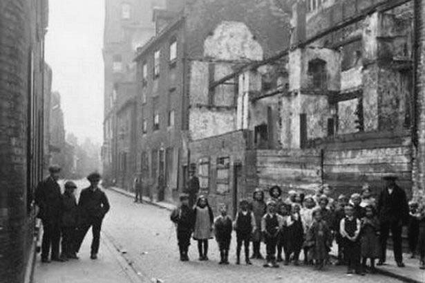
Leen-side is the eastwards continuation of Canal-street to London Road where the BBC is now situated. It ran to the south of Narrow Marsh, where the Nottingham police never dared to go. It was an area generally reckoned to be the absolute very worst slums in the whole British Empire. People who lived there used to queue up to live in the old Meadows. I found a picture of them queuing on the Internet. It’s hard to believe that on the right that group is just one family, but that’s what slums are all about:
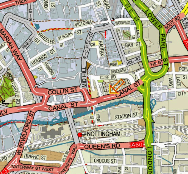
Here is Leen-side, marked with the orange arrow. Just to the north of Canal Street, it used to form an excellent east-west route through the city, and linked well with the route leading south via London Road and the other one going past the red dot of the modern station:
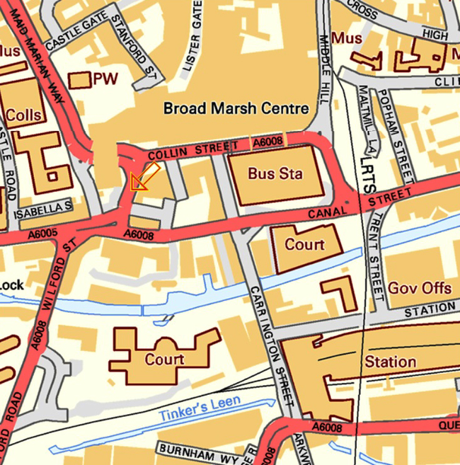
Carrington-street was exactly where it is now and you can see it to the west of the railway station on the map below. In Victorian times, though, it ran a lot further north to a junction with Greyfriars Gate and Broad Marsh, much of which is now covered by the Broad Marsh Centre. Only a small part of Greyfriars Gate remains, between Wilford Street and the Broadmarsh Shopping Centre. I suspect that it used to link up with Lister Gate. I have marked it with our old friend, the Orange Arrow:
There will be more pointed accusations of the slack jawed local planners of the 1960s, and their pathetic and repeated failures to use their brains next time, although I do promise not to mention the fact that they demolished this wonderful old coaching inn and World War II RAF knocking shop without hesitation:

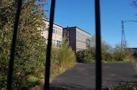
They replaced it with one of the finest examples of sixties architecture in the city: